A large detailed map of New Brunswick
This is a large, detailed map of New Brunswick. There are links to many New Brunswick localities below. Our website format reduces the display size for uniformity. Here is a link to the full-size image that is more easily readable.
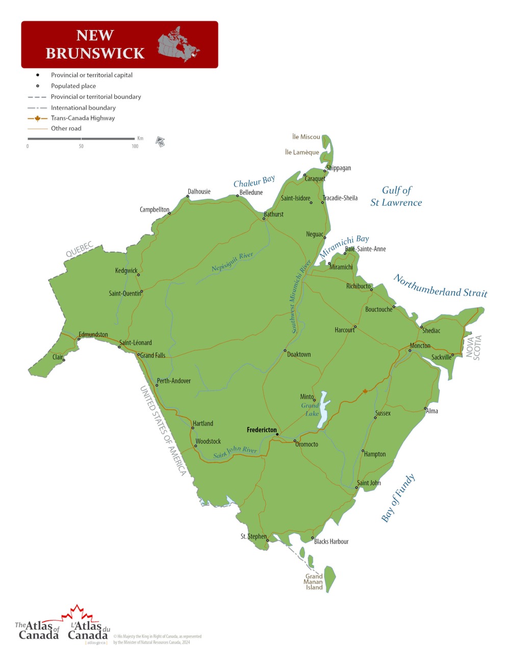
Map © Natural Resources Canada / Government of Canada
New Brunswick — Interactive Map
Explore New Brunswick with an interactive map featuring Street View, satellite and terrain views. Live weather, local news and location details for New Brunswick — built for travel planning and emergencies.
Map search is available for a limited number of queries per session to manage costs. Be specific — search precisely for best results.
| Province / Territory | New Brunswick (NB) |
| Capital | Fredericton |
| Largest City | Moncton |
| Country | Canada |
| Nickname | The Picture Province |
| Latitude | 46.5653 |
| Longitude | -66.4619 |
| Population | 775,610 |
| Cities & Towns | 2,075 |
| Area | 72,908 km² |
About New Brunswick
New Brunswick possesses a rugged interior defined by a vast, rolling plateau that gradually descends toward the Atlantic. Great river systems, most notably the Saint John, carve deep channels through the heart of the land, serving as the essential arteries of the terrain. The northern reaches rise into the ancient, weathered peaks of the Appalachian range, where dense forests of spruce and fir dominate the horizon. Along the eastern and southern coasts, the tides of the Bay of Fundy rise and fall with an intensity found nowhere else on earth, reshaping the salt marshes and sandstone cliffs twice every day. New Brunswick remains a province of cool, misty mornings and bright, sharp afternoons where the air carries the scent of pine and brine. The natural beauty of Fundy National Park and the craggy outcrops of the Acadian Peninsula offer a sanctuary for those who seek the quiet persistence of the wild.
Indigenous peoples have acted as stewards of this land for countless generations, moving across the watersheds and coastal inlets long before the arrival of European explorers. Colonial history shifted the character of the region as French settlers established early outposts, later followed by an influx of British Loyalists seeking a new beginning after the American Revolution. The influence of these diverse arrivals shaped the complex social landscape, leaving behind a dual heritage that continues to define the civil life of New Brunswick. Over the centuries, the maritime borders were solidified through treaties and the steady growth of shipbuilding and timber trades. This evolution transformed small coastal settlements into a structured political entity, firmly anchoring New Brunswick within the broader Canadian federation. Today, the historical legacy persists in the architecture of older towns and the bilingual character that permeates daily discourse.
Forestry, mining, and agriculture provide the foundational strength for the modern economy of New Brunswick. Vast tracts of woodland feed a robust pulp and paper industry, while the fertile soils of the river valleys support potato farming and other harvests that reach markets across the globe. Regional centres like Moncton and Saint John function as vital hubs for manufacturing, logistics, and the burgeoning information technology sector that draws talent to the Atlantic coast. Tourism adds another layer of prosperity, as travellers arrive to witness the dramatic tides and explore the historic harbourfronts. New Brunswick benefits from a strategic position that bridges the gap between the eastern seaboard and the rest of the country, ensuring that goods and services move efficiently across the borders. The economic vitality of the region relies on this balance between traditional resource extraction and the modern requirements of a globalized trade network.
Cultural identity in New Brunswick thrives on a blend of maritime resilience and a deep appreciation for the arts. While the province does not host major league professional sports franchises, local passion is directed toward high-level collegiate athletics and community-focused hockey leagues that draw crowds to local arenas throughout the winter. Every summer, festivals celebrate music and regional cuisine, featuring fresh seafood like lobster and scallops pulled directly from the cold northern waters. Daily life follows the shift of the seasons, where the transition from winter ice to spring thaw dictates the pace of work and social gatherings. The character of New Brunswick is marked by a certain stoicism, a willingness to endure the harsh winds of the Atlantic in exchange for the quiet dignity of a coastal life. This enduring spirit informs the literature, music, and social customs that define the people who call this land home.
New Brunswick Cities, Towns and Communities
A
B
C
D
E
F
G
H
I
J
K
L
M
N
O
P
Q
R
S
T
U
V
W
Y
New Brunswick Maps — Interactive Map, Street View, Weather & News
This page provides an interactive Google map of New Brunswick (NB) with Street View, satellite and terrain views, alongside links to detailed street maps for 2,075 cities, towns and communities across the province. The provincial capital is Fredericton.
Every location page includes live weather through Open-Meteo — with current conditions, hourly outlooks and 7-day forecasts — alongside real-time local and world news feeds. Editorial summaries and location descriptions are included where available, and visitors can search Google directly from each page for additional context.
The Search Maps button below the map opens the Canada Base Map with Toporama contours and shaded relief as base layers, with a labelled UTM grid overlay, a distance and bearing tool, and a single-fix GPS readout giving your UTM/MGRS grid reference and latitude and longitude.
Location data is sourced from the Canadian Geographical Names Database (CGN), Natural Resources Canada, and verified by coordinates rather than name matching alone.